Drone
Surveys
WHAT IS IT ?
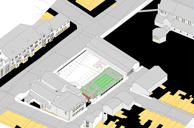
S2P’s drone surveys are characterized by precision, accuracy, efficiency, and speed. So, if your projects need a reliable and cost-effective way to gather data, look no further as we have your back. Using state-of-the-art drone equipment and software tools, our certified pilots will collect survey data accurately and quickly, saving you both time and money.
Our drone surveys serve wide array of applications, including
- Land mapping and topographical surveys
- Building and site inspections
- Asset and inventory management
- Environmental monitoring
- And much more!
Drone Surveys – The S2P Advantage
Choosing S2P for your drone surveying needs comes with benefits that you will not get anywhere else. Let us go through each one of them
Fast & Efficient Data Collection
S2P has harnessed the drone power to make the whole survey process more efficient and faster. Having worked in the fast-paced and complex construction and design industries for over 30 years, we thoroughly understand that the pace at which data is collected significantly impacts your project timelines and deadlines. Likewise, delays translate into increased costs and in some cases lost opportunities.
Therefore, we have made fast and efficient data collection cornerstone of our drone surveys, ensuring that you never miss a deadline or compromise on project timelines. Here at S2P, our latest drones are agile and capable of covering vast areas in a fraction of time, something that you cannot get with traditional surveying methods.
So, if you are associated with construction, agriculture, environment, or any other industry and need necessary surveying data promptly, reach out to us for a tailored quote. By providing you with surveying data, we help you accelerate your decision-making process, enabling you to expedite the progress of different phases of projects and gain a competitive edge in a highly competitive market.
Cost-effective Compared to Traditional
Surveying Methods
Traditional methods are not only time consuming, but they also carry a heavy price tag. Traditional surveying methods require significant manpower and equipment to collect data manually. It means your project expenses may increase and timelines may get prolonged. However, rapid advancements in drone technology means you get data at much higher speed and lower costs, making this surveying technique more cost-efficient.
The cherry on the top is that this cost-efficiency comes without making any compromise on the quality. Our certified pilots streamline the whole data collection process through the agility and efficiency of drones, eliminating the need for bigger teams while slashing the time required to complete surveys. So, if you are associated with fast-paced and complex construction industry and fed up with hefty expenses related to surveying teams, specialized equipment, or prolonged project durations, drone surveys are the perfect solution for you.
opt for S2P’s drone surveying services and get a surveying approach that is more economical and efficient to optimize your overall project costs.
High-Quality & Accurate Data
Insured & CAA Approved
S2P comprises of team that is fully UK-based. It means we understand compliance inside out and some is reflected in the services that we provide. Our drone surveys are insured, and Civil Aviation Authority (CAA) approved. This level of compliance with UK’s laws highlights our commitment to deliver reliable, exceptional, and highly accurate surveying services that goes beyond industry standards.
Likewise, compliance with local laws also highlights our strong commitment to transparency and accountability. To put things into perspective, only those companies get CAA approval that meet or exceed stringent industry standards; our certified drone pilots and cutting-edge equipment comply with stringent standards and safety regulations set by the CAA, showing our commitment to uphold highest level of professionalism.
Therefore, when you opt for our drone survey services, you earn complete peace of mind that you are not only going to receive top-tier data collection but are also insulated from potential risks associated with non-compliance.
Experienced & Certified Drone Pilots
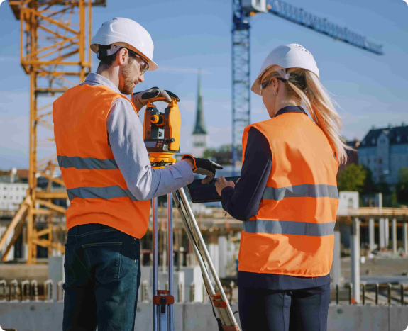
Machines only give exceptional results if they are operated by skilled manpower. Being fully aware of this, we house some of the most experienced drone pilots in the UK. Therefore, our pilots operate drone equipment with utmost precision and navigate the skies with unmatchable skill. Thanks to this experience, you get data that is highly accurate and detailed. Whether it is surveying expansive landscapes, capturing detailed images for analysis, or conducting intricate inspections, our experienced drone pilots have a 100% successful record of accomplishment of encountering and overcoming diverse survey challenges.
It is not the experience we prioritize; compliance with industry standards remains our utmost priority. Therefore, each member of our drone team is a certified drone operator. For us, certification is not just another formality, rather it is a meticulously designed process that ensure drone pilots are well-versed in intricacies of aerial navigation, safety protocols, and operation of highly advanced and cutting-edge drone equipment. Therefore, hiring certified drone pilots is a win-win situation both for us and our clients.
With our certified and experienced drone pilots, you get an additional layer of safety for your projects. Our staff ensure that drone surveys are conducted with utmost care. When it comes to surveys through drones, safety is not an option but a regulatory requirement.
1. Dedicated Account Manager
Survey2Plan keeps its client – you – at the center of everything we do. At the core of our business philosophy is building relationships that last a lifetime. Therefore, when you hire us for your drone surveying needs, you get a dedicated account manager. This dedicated account manager becomes your single point of contact throughout the project lifecycle. He sits with you, understands the unique requirements of your project, and communicates the same to our team.
This clear and robust communication means that you shall get highly accurate and detailed data within agreed-upon deadlines. As a matter of fact, our dedicated account manager becomes the extensi of your team and keeps your business interests as his s first priority.
2. Transparent Pricing
When it comes to business, relationships are built on pillars of transparency and honesty; the same is reflected in our pricing. When you submit your project details, we will provide you with a quote that will be devoid of any hidden charges.
From the very beginning, we set very clear expectations for you by providing you with a thorough understanding of what you are paying for whether it is aerial mapping, site inspections, or data analysis. This transparency in pricing sets the stage for future partnerships while providing you with upfront clarity to help you optimize overall costs throughout the project lifecycle.
Likewise, we understand that every project is different and comes with its unique requirements. The same understanding is reflected in our pricing section. Through tailored and project-specific pricing, we ensure that you receive the best value for your investment. As our project manager is holding a detailed meeting with you, the possibility of unwelcome pricing surprises is eliminated in the form of full disclosure of all costs. Rest assured, the price you see in the quote document will be the price you pay, with no hidden charges lurking in the background.
3. Up to 10 Free Revisions
At S2P, we foster lifelong business relationships by providing professional excellence that goes beyond initial deliverables. To ensure that you are fully satisfied with the outcomes of drone surveys, we offer up to 10 free revisions. Though we take pride in delivering exceptional results the first time, we still leave space for flexibility as we understand that your vision can evolve, and your needs may refine as the process unfolds.
4. Expertise of BIM Experts, Architectural Technicians & Engineers
What separates us from the rest is our team. We are not just another surveying firm comprising surveyors. We are a diverse team of UK-based BIM experts, architectural technicians, and engineers. Therefore, when you partner with us, you get access to a wealth of expertise. Likewise, the models you will receive will be crafted by architectural technicians, ensuring that they capture every detail, are fully accurate and detailed.
FAQs
How long does it take to complete a drone survey?
Every project is unique so there is no predefined timeline for drone surveys. However, the two factors that most influence the duration are the size and complexity of the project. But when compared with traditional surveying methods, drone surveys are cost and time efficient.
Are drone surveys legal?
Only if they are approved by CAA and Federal Aviation Authority. This approval is granted to only those companies that meet the stringent regulations of these bodies. These regulations cover certifications of drone pilots, safety standards, and cutting-edge drone equipment to ensure safe and seamless experience.
How accurate are drone surveys?
When carried out with the latest technology and under supervision of certified drone pilots, such surveys are highly accurate. Besides, the choice of software also influences accuracy. Here at S2P, we use licensed software to deliver results that are exceptional and pin-point accurate.
How do I get started with a drone survey for my project?
Contact us today to learn more about our drone surveying services and how we can help you gather accurate and efficient survey data for your project. We will work closely with you to understand your unique surveying needs and provide you with a customized solution that meets your specific requirements. It is pertinent here to mention that drone survey cost varies from project to project.