“Accurate Terrain Mapping for Precision Planning”
Our expert team exceeds your project needs with unmatched precision and accuracy by using total station, GPS and other equipment.
“Accurate Terrain Mapping for Precision Planning”
Our expert team exceeds your project needs with unmatched precision and accuracy by using total station, GPS and other equipment.
Are you frustrated with project delays and cost overruns from outdated or inaccurate maps?
Poor topographical surveys lead to misaligned construction, unexpected terrain challenges, and expensive modifications.
Survey2Plan’s Topographical Surveys solve this by delivering the most current, precise land data.
We capture every contour and feature, ensuring your project design matches the actual landscape, preventing costly surprises and keeping your project on schedule.

To discuss your project needs & give you a personalised quote.
Our experienced team conduct survey using latest equipment.
Our experts meticulously process data to create accurate and detailed topographical maps.
You get high quality deliverables including contour maps, 3D models, and detailed reports.
Achieve precision in your projects with Survey2Plan’s expert approach!
Accurate terrain data ensures your project plans match the real landscape, avoiding costly errors.
Provide essential data for drainage, grading, and earthworks to ensure sustainable development.
Tailor your project to minimise disruption to natural features and local ecosystems.
Understand the site’s topography for better placement of structures, roads, and utilities.
Detailed surveys help in assessing project viability before significant investments are made.
Accurately map your land with a professional topographical survey.
Accurately map your land with a professional topographical survey.
Building the future of the construction industry, one project at a time.
The project involved a terraced house where the client required an as-built model for a personal renovation project.
Listed Building | Oxfordshire
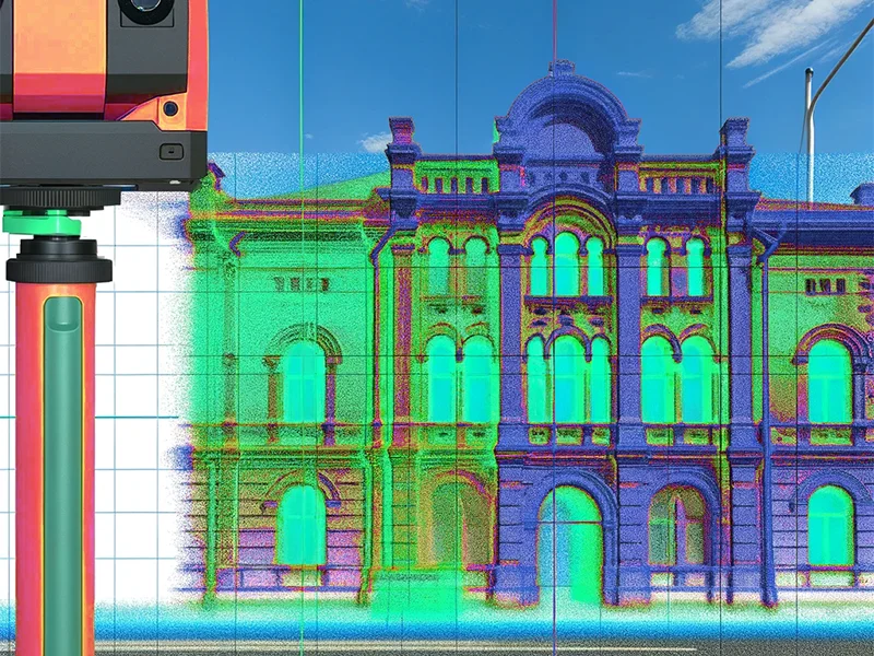
We carried out measured building surveys, topographic surveys, and 3D laser scanning for a historic site requiring…
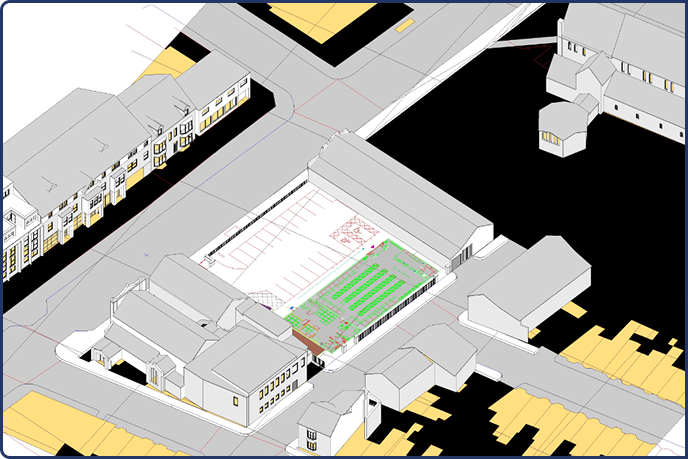
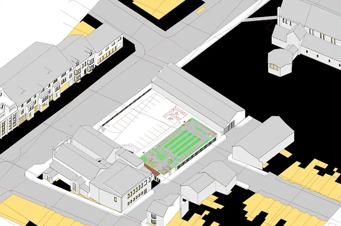
Our company specializes in transforming point clouds into detailed Revit models. The site included five existing buildings and an expansive open…
287 King Henry’s Drive is a terraced house. The client himself is an architect and this is his personal project
The Client was set to embark upon a new construction including an ASDA on ground floor and student acoomodations above on site.
Old Town Hall is a site where the client required the as built plans.
Our latest project at the venerable New College in Oxford stands as a testament to our commitment to quality and detail.

James Mitchell
Property Developer
Sarah Collins
Civil Engineer
Daniel Roberts
Landscape Designer

(Prefer a quick chat? Call us now!)
(Send us an email and we’ll get back to you.)
Bartle House Oxford Court, Manchester, M2 3WQ

Survey2Plan provides precise, tech-driven surveying solutions tailored to meet unique project needs with efficiency and expertise.
0161 531 6641
(Prefer a quick chat? Call us now!)
info@survey2plan.com
(Send us an email and we’ll get back to you.)
Bartle House Oxford Court, Manchester M2 3WQ

