Topographical Surveys

Trusted, qualified, and experienced Topographical Surveyors!
“Accurate drawings, including AutoCAD, so that site designs and plans can be made with confidence.”

Our expert team exceeds your project needs with unmatched precision and accuracy by using total station, GPS (Global Positioning System) and other equipment; we create an in-depth digital terrain model of your land.

  1. Drone survey included
  2. 2D and 3D formats
  3. UK-wide coverage
  4. Fully accredited

Format of our Topographical Surveys Data Delivered

We use following formats to deliver the topographical survey data:

  • 2D AutoCAD DWG, DXF, DWF
  • 3D Digital Terrain Model
  • REVIT Model

Equipment used in Topographical Site Survey

We employ the latest equipment and technology to provide a survey that fulfills the demands of your project.
The following are some topographic survey tools that we use:

  • Global Navigation Satellite System (GNSS)
  • 3D Laser Scanners
  • Ground Penetrating Radar (GPR)
  • Total Station
Previous slide
Next slide

Our Topographical Survey Process

Our specialised surveying team works across various industries, providing topographical surveys tailored to each project’s needs. No topographical survey is too big or small for us. Large-scale land surveys for essential infrastructure projects and residential developments are something we’ve done before.

Topographical survey drawings are provided in CAD 2D and/or 3D as required and in PDF format. Paper and film copies can be supplied if requested.

At Survey2Plan  as top topographic surveyors, we provide a complete solution and can help with various other services, such as site engineering schemes, utility surveys, and as-built surveys.

Try our Free Instant Survey Quotation Tool
Fast, Free and Easy

Why Work with Us?

Architectural Technician-Crafted Models and Drawings

Survey2Plan was founded to address poorly modelled surveys by assembling a team of BIM experts, architectural technicians, land surveyors, and engineers. We ensure precise models and thorough validation by entrusting projects to licensed architectural technicians.

Software Flexibility

We offer flexibility by accommodating plans in various software tools, such as Revit, Vectorworks, or any other 2D AutoCAD software you prefer. Our adaptability lets us meet project needs and integrate models seamlessly into existing workflows.

Validation Before Issuing Models or Drawings

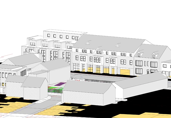
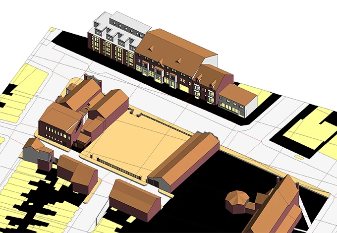
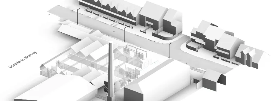
Our architectural technicians perform stern scrutiny to ensure that the models or drawings you receive are not merely a representation but a true reflection of your architectural vision. Our comprehensive approach to topographic surveying guarantees exceptional results.

Innovative Technology

We use innovative technology and traditional techniques to deliver exceptional topo survey results. Specialist equipment such as total stations enables us to provide accurate and detailed models.

Dedicated Account Manager

Our topography survey is to provide a personalised experience to our clients. From initial consultation to project completion in the form of issuance of drawings or models, we assign you a dedicated account manager for a single point of contact.

Up to 10 Revisions

The journey often requires adjustments and fine-tuning, and to cater to this, we offer up to 10 free revisions. This means that even months after the model has been delivered, we remain steadfast by your side, ready to assist and refine as your vision evolves.

Our Projects

ASDA

Topographical Survey
ASDA Linthorpe Road, Middlesbrough, UK

The Client was set to embark upon a new construction including an ASDA on ground floor and student accommodations above on site. It was crucial for his design team to gain a firm understanding of the surrounding context in order to satisty regulatory constraints such as nght to light, the effects or shadows on neighbouring buildings and the sky dome.
S2P modelled the surrounding buildings with intricate attention to window neights and root heights so to ease the process for the clients design team. Details for materials were also captured for the design team to incorporate into their proposals.

How Can We Help?

Let’s discuss how our experienced topo surveyors can support your upcoming project.

With over 20 years of experience, Survey2Plan offers specialised surveying services.

Got a Project?
Get in Touch with us Today!

Got a Project? Get in Touch with us Today!

© 2024. All Rights Reserved. | Survey2Plan

top

Get in Touch

Got a project in mind?

GET A QUOTE NOW
We aim to reply within 10 minutes