Survey2Plan Transparent Logo

Is LiDAR the Same as 3D Laser Scanning?

Understandably, most people are perplexed whether Laser scanning vs LiDAR technologies are the same or separate. Unlike laser scanning, which is a device-based technology, LiDAR refers to a method or procedure involving lasers Specialists in the Architecture, Engineering, and Construction (AEC) sector often use LiDAR technology as a 3D laser scanner for buildings, enabling them to capture detailed data. They then leverage this scanned data to devise 3D BIM models of buildings, rendering them as built and readily available for use. This blog will explore the essence, applications, and transformative potential of laser scanner vs LiDAR.

The Versatility of LiDAR and 3D Laser Scanning

LiDAR and 3D laser scanning are closely linked technologies. In both cases, laser light captures precise spatial information. Although LiDAR is a general term used in many different contexts, 3D laser scanning is frequently linked, especially to terrestrial LiDAR, highlighting its ground-based method of obtaining accurate measurements of objects and surroundings.

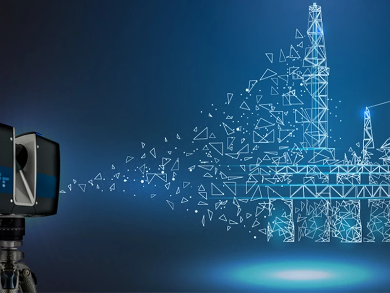
3D laser scanning and LiDAR (Light Detection and Ranging) are revolutionising how we collect and engage with the physical environment. These technologies cover various areas, from media and entertainment to design and construction, and they are not limited to a specific industry.

LiDAR vs Laser Scanning

1. 3D Laser Scanning

Imagine you’re an architect working on restoring a centuries-old building. Every nook, cranny, and intricate detail matters. At that point, Laser Scanning enters the picture like a painstaking painter with a soft brush. It all comes down to accuracy; laser scanning seizes even the most minor details with unprecedented precision.

As stated, laser scanning is all about precision and accuracy. It picks up every detail, from the intricate carving on a door to the curve of a column. It’s like having a very accurate measuring tape that eliminates all space for speculation.

1.1. Applications of 3D Laser Scanning

3D laser scanning has several uses, including reverse engineering, archaeology, dentistry, urban topography, and industrial, architectural, and mechanical dimensional inspection. Let’s discuss the applications of 3D laser scanning below.
Medical industry
Medical practitioners use 3D scanners to collect patient body measurements and guarantee precise measurements for customised wheelchairs, braces, and prosthetics. This accuracy ensures a flawless fit, improving users’ comfort and minimising pain.
Archaeology
Three-dimensional scanners are helpful for digitising tangible artefacts, such as fossils, because the process doesn’t require physical touch. Without destroying the original, archaeological excavations and museums could share high-resolution images of ancient artefacts with the globe. 3D scanners produce digital replicas that are precisely sized and resemble actual artefacts.
Reverse Engineering
Reverse engineering involves disassembling an existing product to learn about its components, design, and operation. It is beneficial when the original CAD drawing is unavailable because it allows one to recreate the product or create an improved version. A thorough overview of the object is provided by 3D scanning, which makes it possible to create CAD files for surface detail capture and engineering analysis.

1.2. Real World Examples

Let’s dive into some real-world use cases of 3D laser scanning technology.
The Empire State Building
By using 3D laser scanning to produce an intricate digital model of the structure, engineers could precisely evaluate the building’s structural soundness and make repair plans.
The Panama Canal
By using 3D laser scanning to produce an intricate digital model of the structure, engineers could precisely evaluate the building’s structural soundness and make repair plans.
The Great Wall of China
The canal’s complex terrain was mapped using 3D laser scanning, yielding important information for organising and carrying out enlargement projects.

1.3. Limitations of 3D Laser Scanning

  1. Expensive for minor refurbishment projects
  2. Seasonal Challenges Outdoors
  3. Challenging in collecting data with occupied buildings
  4. Integration with Existing Workflows
  5. Data Processing and Administration

2. LiDAR

Let’s switch gears. Imagine you are a construction engineer assigned to manage the creation of a brand-new urban infrastructure project. You need to grasp the overall environment thoroughly, not just specific buildings or roads. It includes arranging existing structures, traffic flow, and potential obstructions.

Here’s where LiDAR comes into play. It sweeps its laser beams across the building site to produce an intricate topographical map.

In contrast to laser scanning, which focuses primarily on stationary objects, LiDAR applies in dynamic contexts, like autonomous cars, where navigation and obstacle avoidance depend on real-time mapping of external surroundings.

2.1. LiDAR Equipments

Terrestrial, Mobile, and UAV LiDAR are different LiDAR systems that capture three-dimensional data in various environments. Let’s deep dive into each equipment below.

Terrestrial LiDAR
Terrestrial LiDAR is most used to measure buildings, historical landmarks, and infrastructure in detail. Because of its ground-based setup and high precision, it is an excellent tool for extensive analysis and preservation efforts.
Mobile LiDAR
Mobile LiDAR systems installed on moving vehicles allow quick data gathering across vast areas. The electric vehicle manufacturer Tesla uses Mobile LiDAR technology in its Autopilot and Full Self-Driving (FSD) systems. These systems are excellent for big building projects, urban planning, and film productions requiring extensive outdoor site mapping.
UAV LiDAR
LiDAR scanner-equipped drones allow the technology to cater to unreachable areas. They support planning for agriculture, conducting environmental studies, and collecting amazing aerial photos to produce visual material.

2.2. Applications of LiDAR Across Sectors

The wide range of applications for LiDAR demonstrates its versatility and usefulness:
BIM Modeling
LiDAR in building scans ensures that the construction matches BIM. Aligning a BIM design with the point cloud derived from a terrestrial scan is necessary to provide timely, high-quality construction. The primary benefit is real-time scanning’s ability to identify flaws early in the project. Otherwise, remodelling any faulty building would annihilate both expense and effort.
Flood prediction
Hydrologists create digital elevation models utilising LiDAR’s bare Earth points. Flood modellers can map out locations vulnerable to flooding from here. LiDAR can serve as an early warning system for flooding in this regard. Insurers can use these figures to raise rates.
Forensics Detection
LiDAR in forensics can aid by narrowing the hunt for a missing or unmarked grave. LiDAR can identify minor terrain oddities in the land in archaeology. LiDAR is also helpful when scanning areas for auto accidents or crime scene reconstruction.
Renewable Energy
The best location for solar panels is one of the needs LiDAR can discover for utilising wind and solar energy. It can calculate wind direction and speed to enable wind farm operators to construct and position turbines.

Limitations

  1. Costly
  2. Lousy weather conditions hinder LiDAR function
  3. The data lacks colour, and RGB photo overlays serve to interpret it.
  4. Intricate data sets necessitate proficient analysis to understand

Conclusion

In conclusion, while LiDAR and 3D Laser Scanning both utilize laser technology to gather spatial data, they cater to different needs. 3D Laser Scanning is prized for its precision in capturing detailed features, ideal for projects requiring fine detail, such as architectural restoration. 

LiDAR, on the other hand, offers a broader scope, suitable for dynamic and large-scale environments like urban planning and autonomous driving. Both technologies significantly enhance the accuracy and efficiency of various professional fields despite their distinct uses and limitations.

If you are ready to elevate your project’s precision with expert 3D laser scanning. Contact Survey2Plan today and let our team of specialists guide you to success.

top
Survey2Plan Transparent Logo

Get in Touch

Phone: 0161 531 6641

Got a project in mind?