Best Practices for Conducting Utility Surveys

Best Practices for Conducting Utility Surveys

Best Practices for Conducting Utility Surveys

Imagine breaking ground on a new construction site, only to hit a water pipe that wasn’t on any map. Suddenly, you’re facing costly delays, unexpected expenses, and a host of safety concerns. Unfortunately, this scenario is more common than you’d think. Many projects suffer setbacks because of inadequate utility surveying, leading to unforeseen challenges and inflated budgets. 

These problems arise from a lack of accurate data, poor planning, and outdated surveying techniques. It’s not just a matter of inconvenience; it’s a recipe for disaster that can jeopardize the entire project’s timeline and cost-effectiveness.

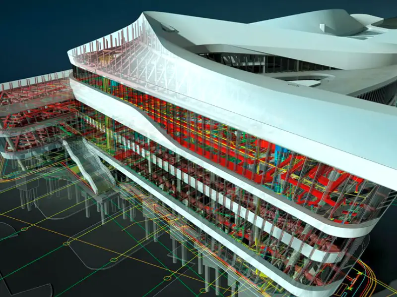
The challenge of pinpointing subsurface utilities accurately is compounded by the complex networks that have developed over decades. Old plans and maps often don’t reflect reality, leaving project managers and construction teams to navigate a maze of potential risks. This is where utility surveying steps in, offering clarity, precision, and peace of mind.

Best Practices for Effective Utility Surveying

In the dynamic world of construction and infrastructure development, understanding what lies beneath the surface is as crucial as the structures we build above it. Utility surveying is the key to this hidden world, providing essential insights that drive successful projects. But without best practices, the potential benefits of utility surveying can be lost in translation.

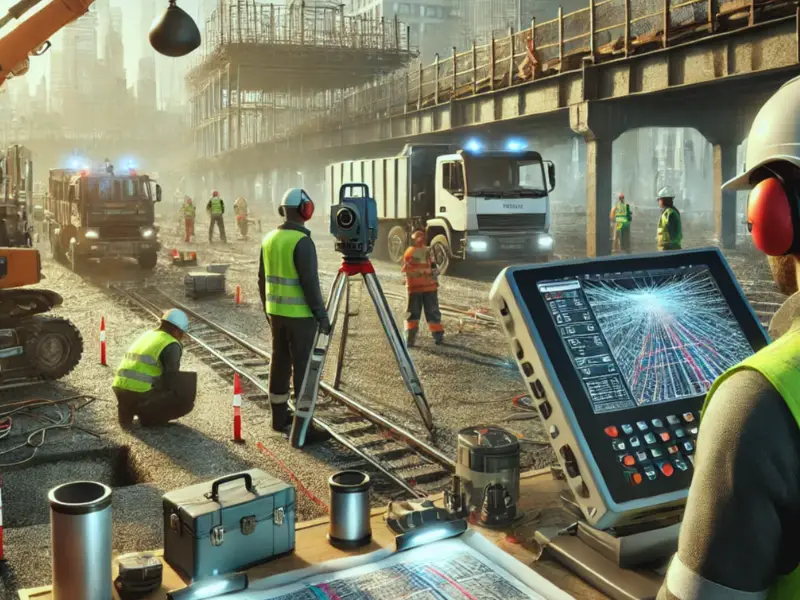
Comprehensive Data Collection and Analysis

Successful utility surveying begins with thorough data collection. This includes gathering existing records and maps, as well as conducting field surveys to update and verify information. Use advanced technologies like ground-penetrating radar (GPR) and electromagnetic location (EML) to detect and map subsurface utilities accurately. These technologies help visualize complex underground infrastructures, ensuring no surprises during excavation.

Implementing Advanced Technology

The adoption of cutting-edge technology is transforming utility surveying. Utilizing technologies like LiDAR and 3D laser scanning provides high-resolution images and models of the terrain. These tools allow for the precise mapping of utility locations, reducing the risk of errors and ensuring efficient planning. Integrating Geographic Information Systems (GIS) with utility surveying practices can further enhance data visualization and accessibility for all stakeholders involved.

Collaboration and Communication

Communication is key to successful utility surveying. Ensure that all stakeholders, from surveyors and engineers to project managers and construction teams, are on the same page. Share data and insights in real time to facilitate better decision-making. Collaboration between teams not only minimizes errors but also optimizes resource allocation and project timelines.

Regular Updates and Maintenance

Regular Updates and Maintenance
Utility surveying is not a one-time task. Regular updates and maintenance of utility maps and data are essential to reflect changes over time. Urban landscapes are continually evolving, with new infrastructure and repairs altering existing utility layouts. By keeping utility data current, project teams can anticipate and plan for potential issues, avoiding costly surprises.

Compliance with Regulations and Standards

Adhering to local regulations and industry standards is a non-negotiable aspect of utility surveying. This ensures that projects not only remain compliant but also benefit from the latest safety and efficiency protocols. Engage with regulatory bodies and stay informed about changes in utility surveying requirements to maintain compliance and minimize legal risks.

Safety as a Priority

Safety should always be a top priority during utility surveying. By accurately identifying the locations of utilities, surveyors can help prevent accidents and ensure the well-being of everyone involved in the project. Implementing strict safety protocols and training teams in best practices minimizes the risk of incidents during excavation and construction.

Efficient Project Planning and Execution

Incorporate utility surveying into the early stages of project planning. By doing so, you can identify potential challenges and address them proactively. This integration helps streamline project execution, minimizes delays, and ensures that resources are used efficiently. A well-planned utility survey sets the foundation for a successful project.

Partner with Survey2Plan for Superior Utility Surveying

Navigating the complexities of utility surveying requires expertise, precision, and the latest technology. That’s where Survey2Plan comes in. With our team of skilled professionals and state-of-the-art equipment, we provide comprehensive utility surveying solutions tailored to your project’s unique needs. Whether you’re planning a small renovation or a large-scale infrastructure project, we have the experience and tools to ensure success.

Therefore, don’t let unseen utilities become a costly surprise. Contact Survey2Plan today and discover how our expertise in utility surveying can transform your project into a seamless success. With our commitment to excellence and safety, we help you unlock the potential of your site while avoiding the pitfalls that can derail progress. Visit our website or call us now to learn more about how we can assist with your next project.

top

Get in Touch

Got a project in mind?