Measured Building Surveys vs. Topographic Surveys: What’s the Difference?
When embarking on any construction, renovation, or land development project, choosing the correct survey type is crucial. At Survey2Plan, we offer both measured building surveys and topographic surveys, but they serve distinct purposes and deliver drastically different outputs.
Understanding their differences ensures you have the right data to make informed decisions without wasting time or budget.
What is a Measured Building Survey?
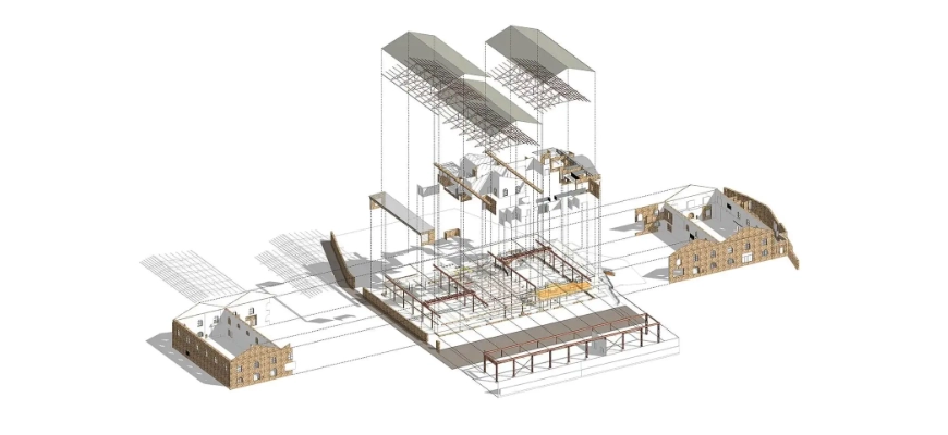
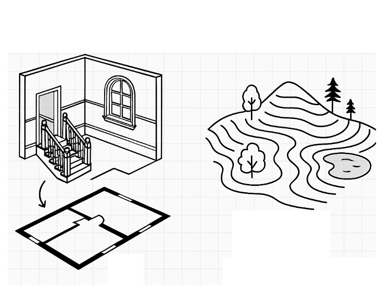
A measured building survey captures every external and internal detail of an existing structure. The goal is to produce precise, scalable drawings floor plans, elevations, cross-sections, and 3D models that accurately reflect the actual built form.
These surveys are vital when:
- Planning refurbishments, extensions, or internal layout redesigns
- Preserving or restoring heritage and listed buildings
- Creating accurate base plans for architects, engineers, and developers
- Initiating BIM workflows and digital twins
Today, high-resolution laser scanners are the gold standard. A single scan captures millions of 3D measurement points (known as a point cloud) within seconds. This data is then processed into accurate CAD files or BIM models that can be used across planning and design teams.
At Survey2Plan, we provide flexible output levels ranging from 2D architectural drawings to complex Scan-to-BIM models that meet industry-specific requirements.
What is a Topographic Survey?
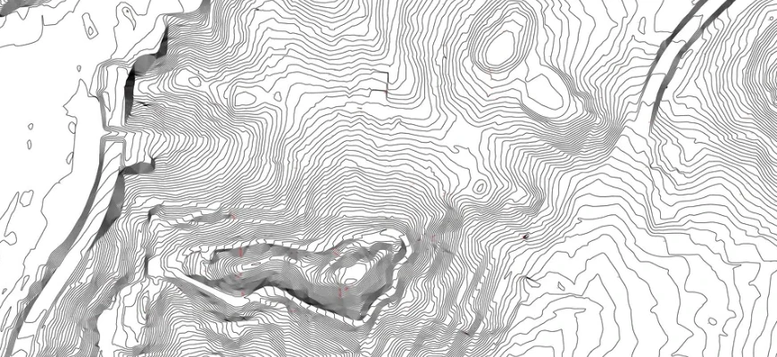
A topographic survey maps the features and shape of the land itself. It records site levels, surface contours, man-made and natural features, boundaries, trees, utility routes, and any structures or obstructions within the survey area.
These surveys are commonly required for:
- Site feasibility studies
- Planning applications for new developments
- Earthworks design, drainage layout, and service planning
- Landscaping, highways, or infrastructure projects
Topographic data is typically gathered using total stations, GNSS receivers, or drone photogrammetry. Survey2Plan delivers this data in layered CAD drawings or terrain models clearly showing gradients, levels, and spatial relationships across the entire site.
Side-by-Side Comparison (Explained in Detail)
Purpose
- Measured Building Surveys focus on the geometry and structure of buildings inside and out.
- Topographic Surveys focus on the surrounding land and site conditions.
Data Scope
- Measured surveys cover walls, doors, windows, stairs, fixtures, finishes, ceiling heights, and more.
- Topographic surveys record levels, contours, trees, boundaries, roads, drainage features, and utility markers.
Survey Tools
- Measured surveys primarily use laser scanners, total stations, and sometimes photogrammetry.
- Topographic surveys use total stations, GPS/GNSS, LiDAR, drones, and remote sensing techniques.
Outputs
- Building surveys produce floor plans, elevations, roof plans, sections, and sometimes BIM models.
- Topographic surveys generate site plans, contour maps, surface models, and geospatial terrain overlays.
Typical Clients
- Architects, heritage consultants, contractors, and facility managers need building surveys.
- Civil engineers, planners, developers, and landscapers rely on topographic surveys.
Real-World Applications: When and Why You Need Each
Residential Projects
- Measured Surveys: Useful for loft conversions, basement extensions, internal reconfigurations.
- Topographic Surveys: Essential for garden redesign, building on a slope, or extending onto surrounding land.
Commercial Redevelopments
- Measured Surveys capture everything from floor heights to column spacing ideal for layout redesigns and structural adjustments.
- Topographic Surveys support planning and civil works, especially for site access, parking layout, or drainage compliance.
Heritage and Conservation
Measured building surveys are often mandatory when working with historic or listed properties. Survey2Plan specialises in high-detail façade scans, capturing decorative elements with millimetre precision ideal for restoration teams and conservation architects.
Combined Use Case: Refurbishment with Site Works
Survey2Plan’s Technical Approach
Our team begins with a pre-site consultation to understand the project scope and required deliverables. Then we deploy the most appropriate tools for the job:
- Laser scanners for detailed internal and external building geometry
- GNSS receivers for wide-area positioning and land mapping
- Total stations for line-of-sight accuracy in tight urban settings
- Drones (optional) for large, open, or inaccessible sites
All data is checked, processed, and presented in clear formats whether 2D drawings, point cloud data, or IFC/BIM files. We work to RICS and PAS 128 standards where required, ensuring that data is not only accurate but also regulatory compliant.
Challenges and Limitations: What to Consider

Measured Building Surveys
- Require indoor access to all rooms
- Furniture and clutter can obstruct data capture
- Listed buildings may need special scanning methods to avoid damage
Topographic Surveys
- Dense vegetation or weather can reduce GNSS signal accuracy
- Utility features may be buried or undocumented, requiring additional tracing
- Land ownership boundaries may not be clearly defined onsite
At Survey2Plan, we address these challenges through advanced planning, safety protocols, and where necessary, specialist utility tracing or structural scanning techniques.
How We Tailor Deliverables by Sector
Architects
Receive layered CAD or BIM models with accurate floor-to-ceiling data and external site overlays.
Engineers
Get terrain models with contours and spot levels, combined with precise utility locations.
Developers
Receive full site and building data in a single coordinated package ideal for feasibility planning and technical design stages.
Heritage Consultants
Receive photo-textured elevation drawings, structural detail scans, and annotated sections for conservation reporting.
Expanded Section: How to Choose the Right Survey for Your Needs
Here’s a breakdown based on project type:
Interior renovation with no outdoor works?: Measured building survey only
New build with site engineering?: Topographic survey is essential
Urban infill or change of use?: Combine both for full context
Planning application support?: Topographic survey with boundary verification
Historic building upgrade or conversion?: High-detail measured survey, possibly with façade scan
If you’re unsure, Survey2Plan will consult with your project lead or design team and recommend the most efficient route.
Conclusion
While both survey types use advanced tools and deliver precise data, their focus is very different. Measured building surveys capture everything within the walls and roofline of a structure, while topographic surveys map what’s outside contours, services, access, and boundaries. Both are foundational to good design.
At Survey2Plan, we help clients get clarity from the start by delivering the right survey for the right purpose, or combining both to ensure seamless design, planning, and execution.
Whether you’re planning a renovation, launching a new development, or managing a complex site with heritage value Survey2Plan provides accurate, dependable surveys that support every phase of your project.
Speak to our team today to get expert guidance on which survey is right for your needs.