
26th May, 2025
Topographic surveys are crucial resources for comprehending a landscape’s traits and features. They offer vital information on an area’s natural and man-made features, facilitating well-informed decision-making in various domains, such as environmental preservation, urban planning, and development.

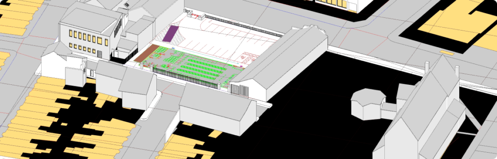
A topographic, topographical, or topography survey measures terrain in great detail to record its heights, features, and shapes. The term “topographic survey” refers to collecting accurate information about the landscape, including the positions of man-made objects like roads and buildings and natural features like hills, valleys, and rivers. Planning and development require a thorough grasp of the landscape, which a topographic survey provides by mapping these components.
Topographic surveys are crucial in many industries. They help make better planning and design possible in the building industry by identifying potential risks, drainage patterns, and site boundaries. Topographic surveys are essential for urban planning because they offer valuable land use and development information, ensuring that projects meet community and environmental objectives. In environmental protection, these surveys also support sustainable development practices by helping to evaluate the ecological variety and the effects of human activity on natural environments.
Several key stakeholders benefit from topographic surveys, including:
Topographical surveys come in several types, each offering specific insights based on the needs of a project. Here are the main types of topographical surveys:
2D topographic surveys are frequently used for small projects like home gardening or straightforward civil works.
LIDAR (Light Detection and Ranging) surveys are highly valuable for projects where dense vegetation obstructs the land surface.
2D surveys provide a comprehensive three-dimensional view of the land. They are helpful for intricate tasks where comprehending the shapes and differences in the landscape is essential.
GPS topographical surveys are ideal for large, open areas like quarries, agricultural fields, or wind farms. They can be efficiently mapped using real-time, high-accuracy data from GPS technology.
A hydrographic survey maps the water’s surface beneath an object. Specialised hydrographic companies solely handle subsea projects.
The cost of completing the survey varies depending on the demands, difficulties, and level of detail needed for the suggested site.
Basic Surveys: For smaller residential projects (e.g., gardens or single residential plots), costs can range from £500 to £1,500.
Medium-Sized Surveys: For larger sites (like commercial developments or multiple residential units), expect costs between £1,500 and £3,500.
Large or Complex Surveys: Depending on the site’s complexity, prices may range from £3,500 to £10,000 or more for extensive projects (such as industrial sites or large-scale developments).
Our experts will provide you with a customized and accurate quote – absolutely free.
call us now at 0161 531 6641 or email at info@survey2plan.com
A topography survey is a detailed understanding of the Earth’s surface features. The detailed process implies multiple components of conducting a topo survey. Let’s dig deeper into those components:
Elevation data is a digital representation of the Earth’s terrain. It can be represented using points such as x, y, and z or in gridded formats or rasters. It is collected using topographic surveying equipment, including GPS receivers, laser scanners, and total stations.
Contours or contour lines are graphical representations of elevation data. This data also includes the connecting points of equal elevation across a certain landscape. Contours are utilized to get hands-on visual representations of landform characteristics, such as valleys, hills, ridges, etc. These features can help understand the terrain better for analysis and visualization.
The established reference points in the collected data are called survey control points. These control points have known coordinates attached to them to ensure accuracy and consistency in the data. Topographical surveyors utilize these control points for survey networking, as this data enables precise spatial referencing and data integration.
Topo surveys also help identify the terrain’s natural characteristics, such as valleys, hills, rivers, etc. They can also determine areas with vegetation. When a topographical surveyor can access such detailed information, they can also determine the land’s ecological diversity.
Along with natural features, topographical surveying also help identify man-made features in a landscape. These man-made features can include roads, utilities, buildings, and other developed infrastructures. When surveyors have access to both natural and man-made features, it becomes easier for them to carry out the planning and development processes.
The process of conducting a topographical survey is a detailed one – covering several steps:
This step of conducting the topo survey involves defining the survey objectives. The surveyors identify the appropriate survey methods and prepare suitable surveying equipment.
This step takes the surveyors to the field, where they are assigned to collect the required data. Data collection includes conducting on-site measurements and determining elevation data. It lets us obtain spatial information by making the most of the surveying instruments.
The step of analysing the data and processing it allows going through raw data and then generating digital elevation methods (DEMs). The surveyors and other concerned individuals can then evaluate terrain characteristics by utilizing modern techniques and software.
This step includes creating accurate and detailed topographic maps after data collection through land surveying, etc. We must also mention that this data helps determine contour plots and detailed reports to showcase survey findings.
Land surveying is an ongoing process. All the data collected through various surveys needs to be stored, updated, and managed properly. When such careful steps are taken, the stakeholders can ensure a smooth project delivery while keeping the data safe and present in one place. Conducting topo surveys facilitates multiple operations and individuals during a project’s lifecycle. However, the process has some challenges and limitations. Let’s examine them to understand the overall process better.
Construction: Assists in precise land measurements, slope analysis, and identifying potential hazards for safe project execution.
Urban Planning: Helps planners design sustainable, efficient city layouts, incorporating green spaces and transport links.
Environmental Studies: Supports impact assessments, monitoring changes in natural landscapes, and conserving ecosystems.
Real Estate: Aids property valuation and development planning by assessing land use potential and boundaries. Historical
Conservation: Captures detailed topography of historical sites, preserving cultural landmarks for restoration and research.

Investing in your development is challenging, but a few key elements will help you achieve your goals. A rapid and precise topographic survey can considerably reduce the degree of risk.
A topographical survey gives you, your planning team, and the local government the extra details you need to understand the area you want to develop. Just as in many situations, information is power; thus, having the right information at the right time will help your project in many ways. Below are some of the key benefits that a topographic survey can bring to your project:
Investing in a topographic survey early in your project helps avoid costly mistakes. The precise information gathered lowers the chances of running into unexpected issues, ensuring your project progresses smoothly.
A topographic survey provides critical information about the land you’re developing. It provides details like site levels, boundaries, and nearby land features, allowing you and your planning team to make informed decisions and refine your designs before proceeding.
Topographic surveys help you avoid expensive mistakes by identifying potential constraints early, such as unstable ground surfaces or trees that need protection. You’ll be able to adjust your plans well before submitting your planning application, saving time and reducing the risk of delays.
A topographic survey provides a complete picture of the land, enabling better design decisions. The survey reveals key information about the site that can influence everything from the choice of foundation to drainage details. It ensures your development is built on solid, well-informed plans.
The detailed data from topographic surveys is invaluable in construction. It enables architects and engineers to plan site layouts, design infrastructure, and develop foundations accurately. This data informs critical design decisions for site grading, drainage, and building positioning, thereby optimizing project efficiency and reducing potential construction errors.
Topographic surveys often integrate with boundary, geological, and environmental surveys to create comprehensive site profiles. For example, a topographic survey combined with a geological survey provides data on both surface features and subsurface conditions, aiding in more informed planning and reducing construction risks.
Surveyors increasingly use digital tools, like CAD (Computer-Aided Design) and GIS (Geographic Information Systems), to process and analyze topographic data. These tools help visualize land features in 3D models, offering insights into site planning and forecasting. Additionally, such technology allows for easy data layering and manipulation, making it easier for teams to simulate potential developments and analyze environmental impact.
At Survey2Plan, we specialize in delivering highly accurate topographic surveys tailored to meet your project requirements. Whether you’re planning a construction project, land development, or need detailed site analysis, our team combines cutting-edge technology and industry expertise to provide the best results.
Prefer to speak to us directly?
Call us at 0161 531 6641
or email info@survey2plan.com
– we’re here to help!

Survey2Plan provides precise, tech-driven surveying solutions tailored to meet unique project needs with efficiency and expertise.
0161 531 6641
(Prefer a quick chat? Call us now!)
info@survey2plan.com
(Send us an email and we’ll get back to you.)
Bartle House Oxford Court, Manchester M2 3WQ
Copyright © 2025 Survey2Plan.