Preserving our cultural heritage is not just about safeguarding our past; it’s about enriching our present and guiding our future. The importance of heritage conservation has long been recognized, but the methods and technologies used in this endeavour have evolved significantly.
Traditional preservation techniques, while valuable, often need to catch up on capturing the intricate details and expansive scopes required for comprehensive heritage documentation. Enter LiDAR technology—a revolutionary tool that offers unparalleled precision and efficiency in cultural heritage preservation.
In this blog, we will explore LiDAR’s advantages over traditional methods, highlighting how this advanced technology transforms heritage conservation and the benefits of preserving heritage through LiDAR. So, let’s dive right into it without further ado.
What is LiDAR Technology?
LiDAR Used in Cultural Heritage Preservation
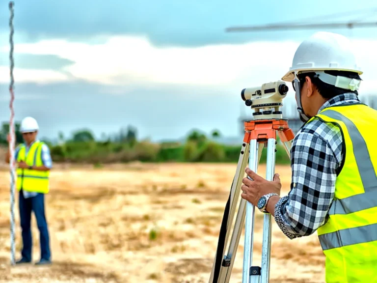
LiDAR technology has been widely applied in cultural heritage preservation. It has proven helpful to archaeologists, historians, and conservationists since it can quickly and accurately map complex environments. This section will cover the primary uses of LiDAR in preserving cultural assets.
Mapping and documenting archaeological sites
Monitoring the structural health of historical buildings
3D reconstruction and virtual reality experiences
Disaster mitigation and planning
LiDAR Technology in Cultural Heritage Management

Planning and decision-making
Conservation and restoration efforts
LiDAR vs Traditional Survey Methods
LiDAR has several benefits over conventional surveying techniques like photogrammetry and ground-based surveys. Among these are a few of these:
- Speed: LiDAR can quickly collect data, covering large areas.
- Accuracy: LiDAR technologies ensure accurate measurements of the studied region with centimetre-level accuracy.
- Density: Many applications can benefit from the rich and detailed point clouds that LiDAR’s ability to collect millions of data points produces.
- Vegetation penetration: LiDAR is superior to photogrammetry in that it can survey regions with dense foliage or forest canopies because it can pierce vegetation.
Prosperous LiDAR Applications in Cultural Heritage Preservation
Pompeii, Italy
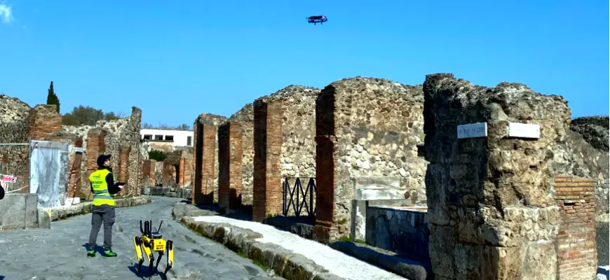
At Pompeii, the historic Roman city buried by Mount Vesuvius in 79 AD, LiDAR has been essential in the ongoing restoration efforts. Researchers have produced intricate 3D models of the site’s infrastructure and structures using LiDAR data, which have been used to guide conservation and restoration initiatives. The data has also helped identify regions at risk from future natural disasters or structural failure and offered insightful information about the city’s original construction methods.
Chichén Itzá, Mexico
LiDAR technology has also benefited the ancient Mayan metropolis of Chichén Itzá in Mexico. Researchers have mapped the site’s structures and surrounding terrain using drone-mounted LiDAR devices, uncovering previously unknown hidden causeways, platforms, and other features. Thanks to this data, archaeologists now have a greater understanding of the city’s layout and relationship to its surroundings, which has led to the development of new theories regarding the city’s purpose and significance in the Mayan civilization.
Angkor Wat, Cambodia
LiDAR technology has been instrumental in uncovering new information about the ancient city of Angkor, home to Cambodia’s famous Angkor Wat temple complex. Hidden beneath the thick forest canopy, aerial LiDAR studies have uncovered a vast and unexplored urban area.
As well as offering critical new insights into the daily lives of its residents, these discoveries have fundamentally altered our view of the city’s scope, intricacy, and infrastructure.
Challenges and Limitations of Drone LiDAR in Cultural Heritage Preservation
Cost and accessibility
Regulatory constraints
Data processing and storage
Limitations in complex environments
The Future of LiDAR in Cultural Heritage Preservation

Are you Planning to Get a Heritage Survey?
If you’re contemplating drone LiDAR technology for a cultural heritage survey, Survey2Plan is the ideal partner to help you reach your objectives. With its proficiency in gathering and analysing LiDAR data and its experience in various industries, Survey2plan can offer customised solutions to satisfy your project’s particular requirements.
In conclusion, LiDAR is an integral tool in cultural heritage preservation thanks to drone LiDAR technology. It makes precise mapping, monitoring, and documentation of historical locations possible. However, technology is still developing, and new developments will present this industry with even more fascinating prospects.
Are you interested in finding out more about the uses of drone LiDAR technology? Read our guide “Is 3D laser scanning the same as LiDAR?” for a comprehensive examination of this intriguing topic. Contact S2P immediately if you require professional drone services for your projects. To fulfil your specific demands, our knowledgeable team is here to assist you in using the potential of drone LiDAR.