Are you planning to have a topographic survey conducted for one of your projects? But before doing that, you’d like to know about the various used topographical survey equipment. Well, know that you have come to the right place. If you are our regular readers, then we are sure that you know that previously, we discussed what a topographic survey is. And how much it costs to perform one.
In today’s blog, we aim to focus on the equipment that are used in conducting a topographic survey. So, let’s dive right into it without any further delays.
Brief Introduction of a Topographical Survey
A topographic survey or topo survey is a detailed mapping of a landscape. In easy-to-understand words, this survey happens to showcase the various characteristics of a piece of land including the natural and man-made features. These features include hills, valleys, ridges and rivers, buildings, roads and other developed infrastructure. This survey is crucial for understanding the Earth’s terrain in a better way to be able to make informed decisions later.
Surveyors across the globe utilize specialized topographic survey equipment to conduct topo surveys. The equipment used in land surveying can get precise and accurate details, hence improving the overall project’s efficiency. Also, the insights gathered from conducting topo surveys help shape the landscape and provide information for archaeological research.
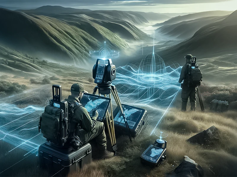
Equipment Used in a Topographic Survey
In this part of the blog, we will talk about the topographic equipment in detail. Make sure that you guys read the blog till the end to know more and make better decisions.
Following are some topo survey equipment:
1. Global Navigation Satellite System (GNSS)
The Global Navigation Satellite System (GNSS) consists of GNSS receivers and three satellite technologies. These technologies are the Global Positioning System (GPS), GLONASS and Galileo. These components of the GNSS play a vital role in conducting surveys, especially in open areas as they have clear visibility to satellite signals. The receivers that are used by the GNSS use signals from several satellites to get correct readings. The data received after surveying happens to be the most accurate geospatial data for mapping terrain characteristics.
GNSS is a preferred tool used for land surveying as it allows quick and accurate data collection, especially over large areas. Projects with strict deadlines are facilitated by the GNSS as the integration of ground control points into datasets is quicker and more precise.
2. Total Station

A Total Station is a highly specialized optical instrument, and it works by combining electronic distance measurement (EDM) with theodolite capabilities. Total Station is an essential tool for conducting a topo survey and offers precise data throughout surveying. Allow us to also share that the Total Stations are responsible for measuring distances and angles to points on the terrain. This feature enables the surveyors to efficiently determine the feature’s coordinates. The coordinates of features include elevation data, contour lines and boundaries.
Total Stations are paired with electronic data collection capabilities which enable data collection in real time. In addition, Total Stations are integrated with Geographic Information Systems (GIS) for comprehensive mapping and data analysis.
3. 3D Laser Scanners
A topo survey also involves advanced laser technology. Modern 3D laser scanners can capture highly precise and detailed point cloud data. The scanners emit laser pulses and efficiently measure the time it takes for the pulses to return from the land which is being surveyed. The 3D scanners then generate accurate 3D representations of terrain characteristics. These characteristics include complex topography and vegetation. 3D lasers provide error-free data in high resolution.
Along with other topographic tools and technologies used, data provided by 3D lasers help in mapping, analysis and spatial visualization.
4. Ground Penetrating Radar (GPR)

Ground Penetrating Radar (GPR) is a geophysical method. This method is non-destructive and is used to investigate subsurface structures. In addition, GPR can also investigate buried objects (if any) present beneath a certain piece of land. GPRs work by transmitting electromagnetic pulses into a piece of land and then analyzing the reflected signals. Furthermore, a GPR system can also pinpoint changes that take place in soil composition. We must also mention that GPRs not only detect underground features but can identify geological features as well. The data collected by GPR technology is useful when it comes to assessing potential risks that can influence a construction project.
We also want to mention other equipment and tools used to conduct topographic surveys. Such as Unmanned Aerial Vehicles (UAVs) or drones, Digital Levels, Prisms and Prism Poles, Tripods and Robotic Total Stations. All these tools improve the efficiency and accuracy of the survey results.
5. Unmanned Aerial Vehicles (UAVs)
Unmanned aerial vehicles, or simply “drones,” have recently earned reputations as vital tools for surveying and aerial mapping projects. These vehicles retrieve photos covering large areas and subtle characteristics about elevation. These gadgets supplement ground-based survey equipment since they can reach dangerous and isolated locations. They open the door to expansive landscape views suitable for various uses.
6. Digital Level
7. Data Processing Software
Robust data processing and analysis tools are essential for numerous reasons. Thanks to software packages for Geographic Information Systems (GIS) and Computer-Aided Design (CAD), surveyors can visualize, manipulate, and organize spatial data with accuracy and transparency. These platforms are also essential for making wise decisions about creating 3D models, volume calculations, and related matters.
Topographic surveying is a constantly evolving field. Innovative approaches and the advent of new technologies propel it. By utilising the software and equipment currently in use, surveyors can overcome challenges and assemble accurate, large data pieces appropriate for a wide range of uses.
Read More: Benefits of Topographic Survey
Conclusion
Previous Post
← Top 10 Applications of 3D Laser Scanning