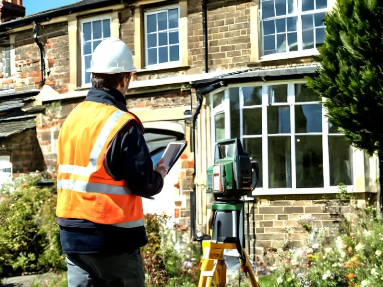
While on the road, do you wonder how the city you live in was planned out and then built? If we are being honest, we do think about that a lot. We are sure that you guys also check out the buildings on both sides of the road but it’s the planning and development that can keep you busy for some time.
Now, coming back to what we have planned to discuss in the article today; the role of surveying in urban planning and development. Let’s dive deeper into the process of surveying and how it aids in carrying out minor to major tasks.
Surveying is the foundation of Urban Planning
Surveying, the foundation of urban planning allows professionals to perform meticulous tasks with ease. From accurate data collection to developing detailed maps, surveying facilitates many stakeholders such as planners, engineers, architects, utility managers, etc. It’s a fact that all the concerned teams are heavily relying on surveyors as they measure and evaluate landscapes. Once that is done, planners are in a better position to make decisions that will determine the way forward.
Surveying includes processes like measuring land boundaries, identifying topographical features and then evaluating land suitability. And that’s not all as surveyors also help planners ensure that their development projects are fully aligned with local, state or federal regulations and zoning laws. Surveying also guides urban planners to ensure that their projects are as per the needs & demands of the community.
To talk about the kind of tools that surveyors, we would like to mention here that technological advancements have made the process of surveying highly precise and accurate. In the past, all the stakeholders had to rely on methods and processes that were time-taking and complex.
Another challenge that was faced by the concerned teams was inaccurate data. However, with technological innovations in use, surveyors have started to see better days. There are GPS, drones, mobile mapping and more such tools that allow users to collect accurate and detailed data. Interestingly, the data can be collected anywhere on the face of the earth and can be about anything such as slopes, elevations, rivers, mountains, etc.
The collected data helps in studying the landscapes as well as identifying potential risks and challenges. Once the surveyors have issued their topographical survey of a certain piece of land, the stakeholders can predict various environmental changes.
For example; the areas that are prone to floods, earthquakes and other such calamities can be identified. After identifying such areas, urban developers can work on redesigning the projects or even relocating the site to somewhere safer. By doing so, the stakeholders not only spend their resources on lands with no or fewer risks but also develop more sustainable infrastructures.
Also Check: Land surveys for urban planning
Surveying facilitates defining Land Boundaries

Urban development is not just about building infrastructures but also about defining boundaries and land ownership. Allow us to mention here that surveying plays a crucial role in doing that through accurate boundary surveys. By studying and then following such surveys, urban planners ensure that they are building an infrastructure within the correct limits on a piece of land. This practice allows the stakeholders to work tension-free without getting involved in property disputes. And it also works great to build a nice, professional image of the concerned companies as well.
We must mention that urban planning is more than just the development of commercial infrastructures. Since residential and industrial developments are also a part of urban planning and development, it becomes crucial for planners to know how much land is theirs to work on. Surveyors offer accurate information to planners after ensuring that the plots, etc. are sized appropriately and are in compliance with local zoning regulations. By making the most of the gained data, all the stakeholders ensure that they are building highly organized residential, commercial and industrial structures.
Suggested: GIS for urban planning
Surveying and Environmental Considerations in Urban Planning
Urban planning does not have to be disastrous for the environment, right? But how will urban planners get to know that the structures they are building are sustainable? Well, that becomes possible with meticulous surveying of the landscapes.
For example; surveying allows the stakeholders to assess the environmental factors that can influence the development of certain infrastructures. Such studies offer the analysis of natural features like wildlife habitats, forests and more. Once the data has been collected, urban planners can work on minimizing environmental disruptions; ultimately developing more sustainable structures.
Surveying is crucial for urban planning and development; allowing planners to build sustainable infrastructures and cities.
If you require guidance on surveying and urban planning and development, then leave us a message right away!


